
FUCK ISRAEL FUCK ISRAEL FUCK ISRAEL
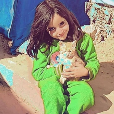
Gaza before the war and Gaza after the war… it has become uninhabitable. Please don’t abandon us; we need your help.
https://gofund.me/d0cc0587
#GazaVerified #israel #genocide #famine #settlerColonialism #apartheid #StopIsrael #STOPtheGENOCIDE
#Gaza
@palestine@lemmy.ml @palestine@fedibird.com
@jeffowski
@simon_brooke
@stephanies
@tsbasatoru
The photos might be from different sensors/cameras. You can also notice that the second seems to have a different lens angle of view.
But why not use images taken with the same instrument at the exactly the same time of the year? Because we don’t have availability! Companies like maxar definitely have standardized high resolution aerial images from the entire world at regular intervals, but these images aren’t free to the public, so we have to do with what we have available.
If skeptical, you can use google earth to see some high resolution historical images of the place, or you can grab some lower-resolution images from copernicus