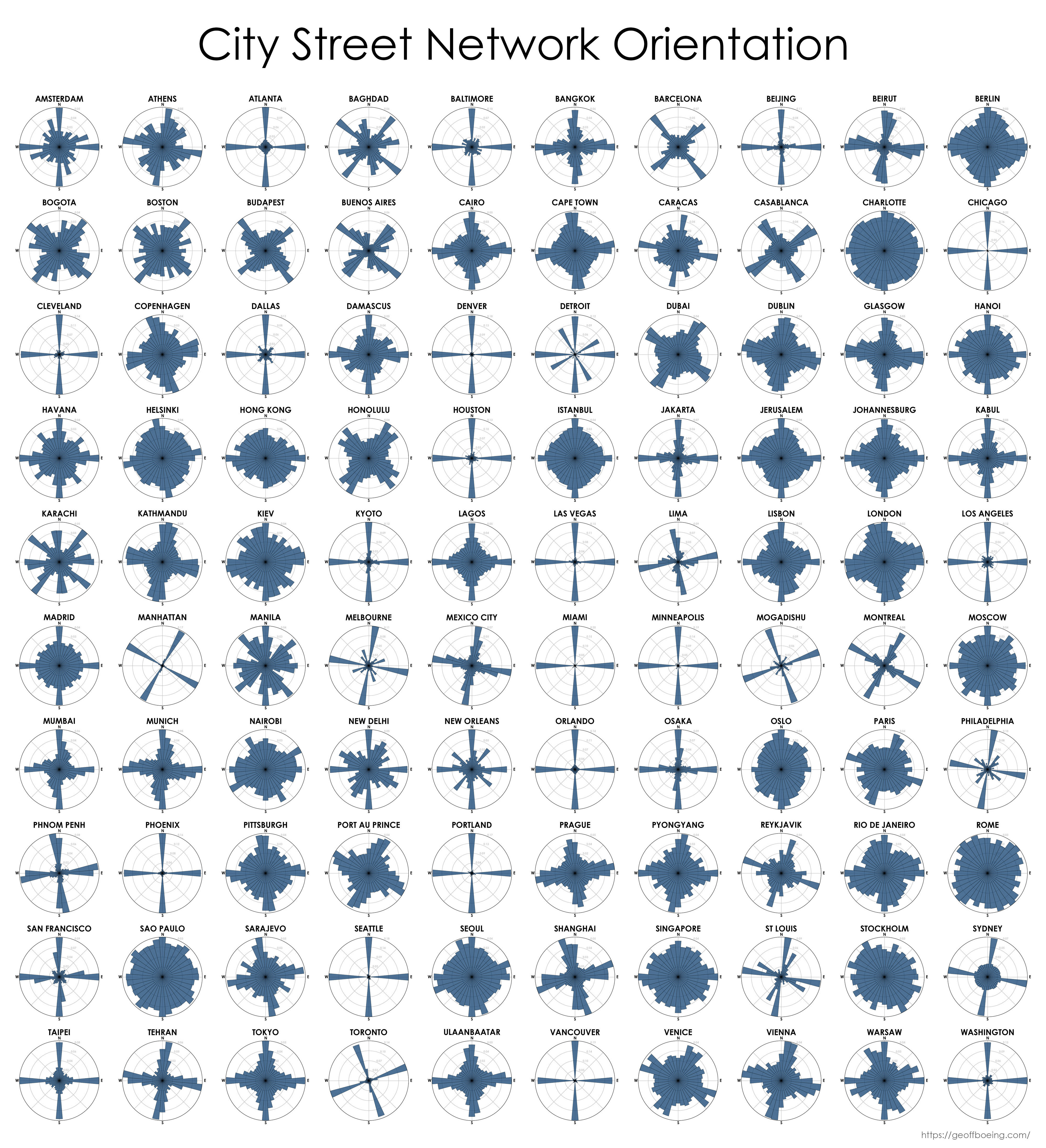
I might be a moron here, but I have no idea how to interpret this. Is each blue bar the proportion of streets that run in that direction? Do the ones that just have a single bar at N/E/S/W have perfectly aligned streets that only go in the cardinal directions?


I might be a moron here, but I have no idea how to interpret this. Is each blue bar the proportion of streets that run in that direction? Do the ones that just have a single bar at N/E/S/W have perfectly aligned streets that only go in the cardinal directions?
Here’s a portion of detroit:
The city is almost entirely grid, some of it at an angle. You can see these two grids visualized in the post.